

© Shipping Wonders of the World 2024 | Contents | Site Map | Contact Us | Cookie Policy

The Caribbean
Separated from the Atlantic by a chain of islands of great variety and beauty, the Caribbean Sea, though sometimes swept by terrible hurricanes, has many attractions. It has been restored to the trade routes of the world by the opening of the Panama Canal
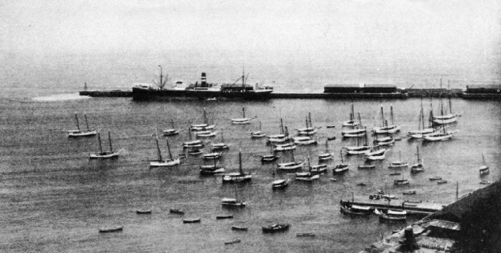
ON THE SHORE OF THE CARIBBEAN SEA, La Guaira is the most important harbour of Venezuela. Here vessels are loaded, among other things, with crude oil, which they take to the Dutch islands of Curasao and Oruba for refining. The ship at the quayside is the Harrison liner Actor, of 5,548 tons gross. She has a length of 410 ft. 3 in, a beam of 52 ft. 3 in. and a depth of 30 ft. 3 in.
FOR variety and charm the Caribbean Sea, the cradle of the New World, is fascinating. It is separated from the Atlantic Ocean and the Gulf of Mexico by a chain of beautiful islands extending from Yucatan and Florida to the mouths of the Orinoco River. The Caribbean coast of northern South America is the Spanish Main of romance. The name Spanish Main has been loosely applied to the Caribbean, but correctly applies only to the mainland which was formerly under the flag of Spain.
The great archipelago known as the West Indies is a vast panorama of scenery and humanity, and encloses a sea almost always bathed in glorious sunshine, but sometimes swept by hurricanes which wreck ships and ruin cities. The smaller islands are shared by Great Britain, France, the United States and Holland; but Cuba, the largest, is a republic, and the next largest, Haiti, comprises two republics. Although Spanish is the language of all the mainland, except British Honduras, and of many of the islands, Spain has no territory in the Caribbean.
From the time of Columbus to the beginning of the nineteenth century, the Caribbean was one of the most important seas. Then it declined until the twentieth century. The opening of the Panama Canal and the building of huge oil refineries on the Dutch islands off Venezuela have restored the Caribbean to the trade routes of the world and opened a new chapter in its chequered story.
In the Caribbean are seen cruising liners which have steamed south from Europe and the United States to enable holiday makers to avoid the northern winter. In contrast to these floating hotels are a few sturdy little schooners from Newfoundland which have brought sun-
To get the full flavour of the Caribbean it is best to be in a small sailing yacht, for so close are the links in the chain of islands that it is possible to sail from one island to another without making a protracted passage. There is usually enough wind and sea blowing from the Atlantic through the gaps between the islands to provide excitement.
So terrible are the hurricanes of the West Indies that the records of them cover a period of more than three centuries, and from the time of Columbus those who survived them have tried to record their experiences and observations for the benefit of mariners and colonists. Statistics of the earlier years are necessarily vague, because scientific observation was hampered by the lack of suitable instruments. Records, however, show that there is not one month in the twelve when the whole of the West Indies is entirely immune. On the other hand, gales may have been recorded as hurricanes in the old days, and observations in modern times show that August, September and October are the most dangerous months.
Statistics for a period of forty-
At one time navigation in the worst hurricane zones of the Caribbean was almost suspended during the hurricane months, and even now small craft are hauled out of the water. Steam, radio and meteorology enable the regular shipping services to be maintained. Ships avoid the worst of the hurricanes by altering course at sea in accordance with the news sent to them by radio or, if they are in port, they wait until the hurricane has moved elsewhere. Some of the hurricanes have a wind velocity exceeding 100 miles an hour, kill thousands of people ashore and do damage amounting to millions of pounds. Even the largest ships have to bow to the hurricane, and if a small vessel is caught with land under her lee, her chances of escape are small.
The hurricanes are circular storms which blow spirally in an anti-
Descendants of Slaves
The word cannibal is derived from Carib, for the fierce savages of this name ate human flesh. The Caribs survived for centuries. As untamable as wolves, they were killed but not enslaved. In the eighteenth century most of the remnant of them were taken from their last strongholds in the West Indies, Dominica and St. Vincent, by the British and sent to an island off Honduras from which they have spread to the mainland.
To-
Except for an occasional yacht the old sailing track from Europe to the West Indies is an ocean highway of the past. Sailing yachts from Europe bound out from the English Channel steer south to get out of the westerlies and pick up the north-
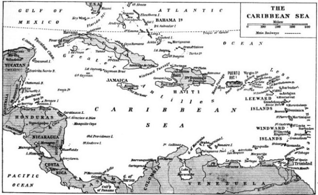
BOUNDED BY A GREAT ARCHIPELAGO, the Caribbean Sea extends from the Yucatan Peninsula, Mexico, to the mouths of the Orinoco River, a distance of nearly 2,000 miles. The numerous islands of the groups that comprise the West Indies are shared by Great Britain, France, the United States and Holland, with the exceptions of Cuba and Haiti, which are independent. The Caribbean offers unrivalled opportunities to the navigator of a small sailing yacht, since it is possible to sail from one island to Another without making a long passage.
Carlisle Bay is a good anchorage on the leeward side of the island. The Carenage, an enlargement of the mouth of a stream that enters the sea through Bridgetown, the island capital, is too narrow and shallow except for the schooners and small craft which crowd it. Ships from Europe, Canada, the United States and countries beyond the Panama Canal make Bridgetown a port of call. There is an extensive trade between the British West Indies and the Dominion of Canada. Dollars and cents are currency in Barbados as well as pounds, shillings and pence.
Trinidad, now prosperous, is also different-
The asphalt flows to the surface and hardens. Then it is dug out and shipped from a neighbouring pier to all parts of the world, where it is used to make roads and for other purposes. The development of the oilfield has added to the prosperity of the island. Port of Spain, the capital of Trinidad, has made great strides in recent years and the days are gone when scavenger birds were relied upon to maintain sanitation.
The Spaniards had such difficulty in sailing into Port of Spain that they called the channel between the mainland and the north-
Tobago, an island dependency of Trinidad, is some twenty miles off the north coast.
Disastrous Volcanic Eruptions
Trinidad is the cross-
With Barbados as the eastern sentinel the islands stretch north from Trinidad to Antigua, where they begin to turn west to the Greater Antilles, the largest of which is Cuba. The first group is the Windward Islands, the seat of government being at St. George, the capital town of Grenada. North of Grenada is a chain of about a hundred islets and rocks called the Grenadines and then comes a larger island, St. Vincent, which lies west of Barbados. Its volcano, the Soufriere, a name which is applied to many volcanoes in the West Indies, erupted in 1902 at the same time as Mont Pelee, in Martinique, killing about 1,300 people and devastating the island. The magnitude of the damage was overshowed by that at Martinique, but it was grievous. St. Vincent, in the same way as Barbados, is not often troubled by hurricanes.
St. Lucia, the next island, is on the edge of the hurricane zone, and storms which have devastated Martinique have missed it by a few miles. It is volcanic and has a sulphurous mountain with hot springs. The harbour of Port Castries, on the west coast, is one of the best in the Caribbean.
Across the St. Lucia Channel is the French island of Martinique. Despite the fact that Martinique has suffered from volcanic eruptions and hurricanes, it is busy and prosperous. Fort de France harbour attracts considerable shipping, some of the vessels coming in to be dry-
Along the coast from Fort de France are the volcano of Mont Pelee and the ruins of St. Pierre, formerly the largest town in the island. The entire population of 30,000, except for one man, who was a prisoner in a dungeon of the gaol, was wiped out in a few seconds on May 8, 1902. The volcano shattered the lava crust which was obstructing the crater, a gust of poisonous gas swept over the city and burst into flame. Seventeen ships were in the roadstead, and only one, the British steamship Roddam, escaped, steaming through a rain of burning lava with members of her crew dying at their posts.
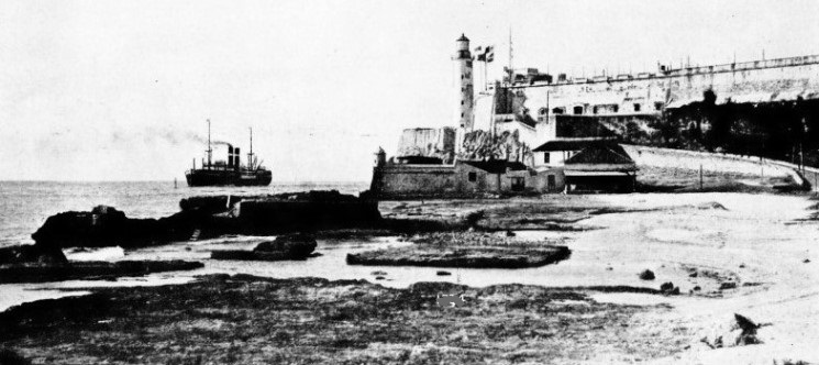
THE SIGNAL STATION AT HAVANA, capital of Cuba, which is the largest island in the West Indian group. The approach of a ship, such as the Holland-
The neighbouring British island of Dominica is the first of the Leeward Islands. It would be hard to say which is the loveliest island in the world, but Dominica is among the most beautiful. Roseau, the capital, is on an open roadstead where the beach is steep, so that vessels anchor close to the shore.
Guadeloupe, to the north, is a French island. This island has a cluster of smaller islands which include Marie Galante and Les Saintes, the latter being the scene of the battle of the Saints, where Rodney achieved victory over the French. Guadeloupe is divided by a narrow, shallow channel, called the Salt River, into Grande Terre and Basse Terre. The capital is the town of Basse Terre, and Pointe a Pitre is the chief town and port of Grande Terre.
North of Guadeloupe is a succession of smaller islands. Montserrat (British), to the north-
St. Kitts and Nevis are British, but the neighbouring islands of Eustatius, or Statia, and Saba are Dutch, and a third island, St. Martin, is divided between France and Holland, although the inhabitants speak English. Yet another island, St. Bartholomew, was colonized by the French, then became Swedish and finally French.
Boat-
Saba is the most remarkable island in this area. It is a volcano rising 2,820 feet almost sheer out of the sea, and although it has no secure harbour and no timber, it is famous for boatbuilding and seamen, and the inhabitants speak English, not Dutch. Their tiny town is nearly 1,000 feet above the sea, and they have to climb up to it by the Ladder, steps cut in the rock. The boats built at this height are lowered over the edge of the cliff by a cable.
St. Croix, or Santa Cruz, west of Saba, and others of the Virgin Islands were Danish until 1917. Then the Danes sold their islands to the United States. The Danes at home were pleased, but the planters in the islands were sorry, because the United States adopted prohibition and killed the industry of the islands, which was rum distilling. St. Croix, the most southerly of the whole of the hundred or so islands and rocks in the Virgins group, many of which belong to Great Britain, is well cultivated as the contour is undulating and not a jumble of volcanic peaks.
Puerto Rico is the smallest of the Greater Antilles, but it is a large island about 100 miles long. Since the Spanish-
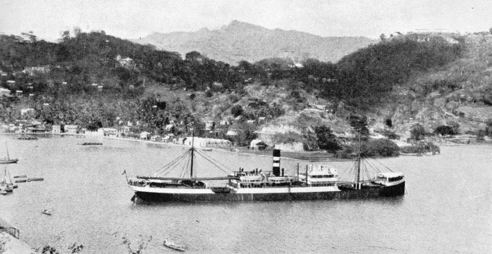
THE CHIEF TOWN OF GRENADA, St. George, is the seat of government of the Windward Islands, which stretch north from Trinidad to Martinique. In the harbour of St. George vessels anchor in 50 or 60 feet of water, and are loaded and discharged by lighters. The Government wharf can be reached only by vessels drawing 8 feet or less. The ship in the harbour is the Specialist, of the Harrison Line. She has a gross tonnage of 4,287, a length of 370 ft. 4 in, a beam of 50 ft. 5 in. and a depth of 25 ft. 9 in.
Formerly called Hispaniola, the island of Haiti is about the size of Scotland and consists of two republics, Santo Domingo to the east, and Haiti to the west. A long promontory on the south coast ends in Cape Beata, off which is an island, Isla Beata, with another island named Alta Vela lying beyond that. The wind blows through Mona Passage between Puerto Rico and Haiti as if through a funnel and its velocity is increased by the contour of the mountains of Haiti, so that the passage under sail to Cape Beata is often fast and exhilarating, although the swell near the Cape is heavy. The inshore channel is too shallow for ships, but the second channel between Isla Beata and Alta Vela is wide and deep, and ships pass through instead of going south of this island. On the westward side the wind often fades and the sailing vessel may lie becalmed for hours and even days until she is set by the current into a patch of wind.
Tortuga, the island off the north coast, Was the first stronghold of the buccaneers — the Brethren of the Coast. Soon after the British and French settled at St. Kitts, the Spanish attacked it and some of the French sailed in small boats to the north coast of Haiti, where they hunted wild cattle and smoked the flesh into bucan, an article of food in those days.
The Spanish soon sent a force to exterminate these bucaniers, or buccaneers, but they moved across to Tortuga. When the Spaniards followed they went back to Haiti, until they were strong enough to fortify Tortuga and hold it. Then they attacked Spanish ships, and Tortuga became the rendezvous of French, British, Dutch, Danes and Swedes, who preyed on the Spanish. They did not degenerate into pirates until long afterwards. Their numbers grew and they brought such wealth to the ports that harboured them, particularly Port Royal, Jamaica, that these places became notorious.
To-
Prosperity from Prohibition
The last great earthquake was in 1907, when the city was destroyed, but it has been rebuilt into one of the most attractive ports in the West Indies. Liners, freighters and warships berth at the piers, and behind the city the mountains make a majestic background. The Jamaican is noted for his enterprise, and the briskness of Jamaica is refreshing after the lethargy of the smaller and less prosperous British islands and the beggars who pester the visitor for alms.
North of Jamaica is Cuba, far and away the largest and richest island of the Caribbean. Havana, the capital, is known as the Paris of the West. To the north-
Prohibition in the United States brought prosperity to the Bahamas. After the repeal the islands retained the tourist traffic, and now attract liners from the United States. Throughout the West Indies sail continues, not for pleasure but as part of the sea-
Across the strait from Cuba is Yucatan, a long peninsula which is part of Mexico. South along the coast is British Honduras, the capital of which, Belize, was devastated by a hurricane not many years ago. The coast-
The rugged coasts of Colombia and Venezuela frown upon a sea from which the galleons of Spain have passed. From ports which once sheltered the treasure ships come vessels laden with crude oil which they take to the refineries on the Dutch islands, where it is treated and shipped out of the Caribbean. Petroleum is now the treasure of the Spanish Main.
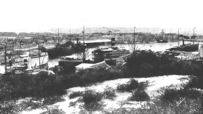
CARACAS BAY, CURACAO, is five miles east of Willemstad, the capital of the island. Curacao is an important oil-
You can read more on “Fruit Carrying Ships”, “The Panama Canal” and “Thames to Tahiti” on this website.